
Chelan County - Ohme Garden Road
Summary
Project type: Noxious weed mapping
Target pest: Myrtle Spurge (Euphorbia myrsinites)
Project date: 12/8/23
Survey area: 8.5 acres
Chelan County Noxious Weed Control Department contacted us to assess and treat a large infestation of Myrtle Spurge. The infestation is on a step hillside that they deemed too unsafe to survey and treat on foot due to cliffs, loose rocks, and presence of rattlesnakes.
We conducted a High Precision Survey of the 8.5 acres then used AI to identify Spurge within it. We delivered back to them a prescription map with the locations of 196 plants and a treatment plan. We will be back this spring (2024) to spot spray using our spray drone.
We will follow up in the fall to do a monitoring survey to assess progress of the treatment plan and efficacy of our aerial herbicide application.
Interactive Noxious Weed Map
The map below is interactive. You can zoom in and out the same ways you would when using Google Maps. You can also switch between the default 2D view and a 3D (really 2.5D) view.
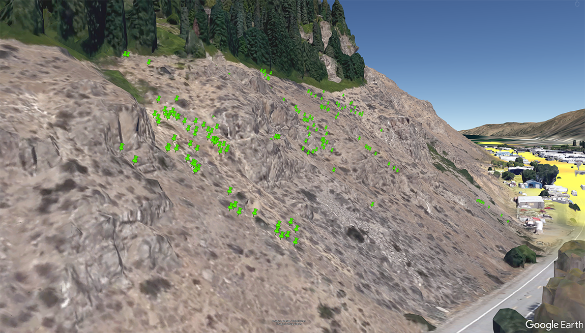
Screen Shot From Google Earth